
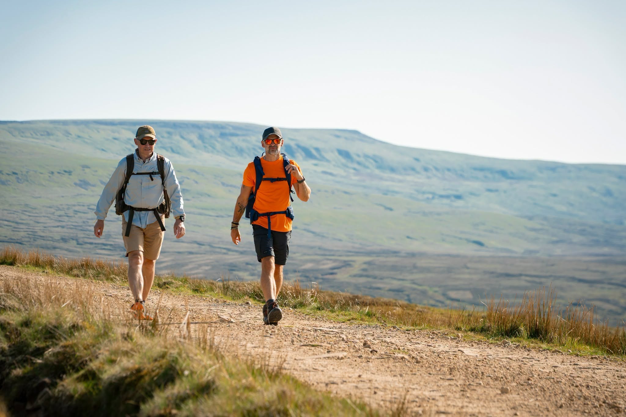

A spectacular new 120-mile walking route stretching across eastern and southern Cumbria will officially launch on Tuesday 15 September 2026.
The Westmorland and Furness Way connects Alston, high in the North Pennines, with Furness Abbey near Barrow-in-Furness, travelling through some of Cumbria's most varied landscapes along the way.
The signed long-distance trail has been developed by Westmorland and Furness Council, building on an initial concept by local walker and guidebook writer David Pitt. It uses existing trails where possible to create one continuous route through the North Pennines National Landscape, Yorkshire Dales National Park, Lake District National Park and landscapes around Morecambe Bay.
Walkers can tackle the entire route as a multi-day adventure or divide it into six principal sections. The council estimates that completing the whole route will take around 8 to 17 days.
Westmorland and Furness Way at a glance
- Official launch: Tuesday 15 September 2026
- Total distance: 120 miles
- Start: Alston
- Finish: Furness Abbey
- Number of principal sections: Six
- Estimated end-to-end time: 8 to 17 days
- Landscapes: North Pennines, Yorkshire Dales, Lake District and Morecambe Bay
- Walker's Passport: A new stamping scheme is being introduced at participating venues
The official launch takes place as part of Sedbergh Walking and Wellbeing Festival, which runs from 14 to 20 September 2026. You can also see the Westmorland and Furness Way launch event listing.
When does the Westmorland and Furness Way open?
The Westmorland and Furness Way will be officially launched on 15 September 2026.
Many of the public rights of way and established paths used to form the route already exist, but the launch marks their presentation as a single signed long-distance trail with dedicated route information, signage and interpretation.
The exact public launch ceremony time and meeting arrangements had not been published when this guide was checked on 12 August 2026. Anyone travelling specifically for launch-day activities should check the latest official festival information before setting off.
Where does the Westmorland and Furness Way go?
The trail begins at Alston before heading south through the North Pennines and Eden Valley. It continues through or close to communities including Dufton, Appleby-in-Westmorland and Kirkby Stephen.
From Kirkby Stephen the route reaches the Howgills and Sedbergh, then continues west towards the Lake District. It passes towards Burneside and Staveley before reaching Bowness-on-Windermere.
After crossing Windermere, the route heads through the Furness woodlands and foothills towards Ulverston. Its final stage uses part of the King Charles III England Coast Path around the Furness Peninsula before finishing at the historic ruins of Furness Abbey.
Westmorland and Furness Way route sections
The official route is divided into six principal sections, allowing walkers to complete shorter day walks and weekends as well as a full end-to-end journey.
SectionRouteDistanceSuggested time 1Alston to Milburn16 miles / 26km1 to 2 days 2Milburn to Kirkby Stephen23 miles / about 37-38km2 to 3 days 3Kirkby Stephen to SedberghLow: 16 miles / 26km; High: 18 miles / 29km1 to 3 days 4Sedbergh to Bowness-on-Windermere27 miles / 43km2 to 4 days 5Bowness-on-Windermere to Ulverston21 miles / 34km1 to 3 days 6Ulverston to Furness Abbey17 miles / 27km1 to 2 daysSection 1: Alston to Milburn
Distance: 16 miles / 26km. Estimated time: 1 to 2 days.
Called Over the Pennines, the first section leaves Alston and crosses the North Pennines towards Milburn. The official route information describes this as a high-level start to the journey and includes the highest point on the entire Westmorland and Furness Way.
This is one of the more remote parts of the trail, so walkers attempting it as part of a multi-day journey should plan food, accommodation and onward transport carefully.
Section 2: Milburn to Kirkby Stephen
Distance: 23 miles / around 37 to 38km. Estimated time: 2 to 3 days.
Following the Eden carries the route south through the Eden Valley towards Kirkby Stephen. The stage passes through or close to places including Dufton, Appleby-in-Westmorland, Warcop and Brough.
Appleby and Kirkby Stephen are useful stopping points for accommodation, food and public transport, with both served by the Settle to Carlisle Railway.
Section 3: Kirkby Stephen to Sedbergh
Low route: 16 miles / 26km. High route: 18 miles / 29km. Estimated time: 1 to 3 days.
Exploring the Dales and Howgills is unusual because walkers have a choice of two official alternatives. The high-level option crosses the Howgills, while a less strenuous low-level route follows their eastern side.
The official guide recommends using the lower route during poor weather because the high ground is exposed and conditions can make navigation significantly more demanding.
The stage links Kirkby Stephen with Sedbergh, opening up further opportunities for walking breaks in the Westmorland Dales and Howgills.
Section 4: Sedbergh to Bowness-on-Windermere
Distance: 27 miles / 43km. Estimated time: 2 to 4 days.
At around 27 miles, From the Dales to the Lakes is the longest of the six principal sections.
The route heads west from Sedbergh towards the Lake District, eventually reaching Bowness-on-Windermere. Burneside and Staveley provide useful intermediate public transport connections on the Lakes Line, with services towards Kendal, Windermere and Oxenholme.
The finish at Bowness-on-Windermere also provides one of the widest selections of accommodation, restaurants and visitor facilities anywhere on the route.
Section 5: Bowness-on-Windermere to Ulverston
Distance: 21 miles / 34km. Estimated time: 1 to 3 days.
Through Furness Woodlands and Foothills begins with the journey across Windermere before continuing through the countryside towards Ulverston.
The official route covers approximately 21 miles and includes about 980 metres of ascent. Much of the countryside between Bowness and Ulverston is rural, so walkers should plan accommodation and food stops in advance.
Nearby Lake District attractions include Claife Viewing Station and Hill Top, Beatrix Potter's former home, making this section particularly useful for visitors combining a walking holiday with sightseeing.
Section 6: Ulverston to Furness Abbey
Distance: 17 miles / 27km. Estimated time: 1 to 2 days.
The final stage, Along the Furness Coast, leaves Ulverston and follows part of the King Charles III England Coast Path National Trail towards Barrow.
This coastal section offers changing views across Morecambe Bay before the Westmorland and Furness Way heads inland for its finale at Furness Abbey.
The dramatic red sandstone abbey ruins provide a fitting destination after a 120-mile journey across Cumbria.
How long does the Westmorland and Furness Way take?
Westmorland and Furness Council estimates that walking the complete route will take approximately 8 to 17 days.
The broad range reflects the flexibility of the trail. Experienced long-distance walkers may combine stages and cover considerably more ground each day, while others may divide the six principal sections into shorter walks.
There is no requirement to complete the whole Westmorland and Furness Way in a single trip.
Can you download the Westmorland and Furness Way route?
Yes. Detailed official pages are now available for individual sections of the trail, including interactive mapping and downloadable GPX files and Ordnance Survey mapping links.
Walkers should use the latest official mapping when planning a journey, particularly while the final launch preparations and waymarking are being completed.
What is the Westmorland and Furness Way Walker's Passport?
Westmorland and Furness Council has confirmed that a special Walker's Passport scheme is being introduced alongside the trail.
The scheme will feature designated stamping points at participating venues along the route. It is intended to give walkers a way to record their progress while encouraging spending with local businesses and support for charities.
The full list of participating stamping locations had not been published when this guide was checked on 12 August 2026, so Cumbria Guru will add those locations once they are officially confirmed.
Getting to the Westmorland and Furness Way by public transport
Several sections of the trail can be linked with public transport, making it possible to walk individual stages without completing the full 120 miles.
Appleby and Kirkby Stephen are served by the Settle to Carlisle Railway. Further west, Burneside and Staveley have Lakes Line stations, providing connections with Kendal, Windermere and Oxenholme.
Bowness-on-Windermere is linked by bus with Windermere railway station, while Ulverston and Barrow-in-Furness both have rail services on the Furness and Cumbrian Coast routes.
Alston is more remote and rural public transport can be infrequent, so anyone planning an end-to-end journey should check current timetables before booking accommodation.
Where can you stay along the route?
Accommodation is likely to be one of the most important parts of planning a complete Westmorland and Furness Way journey.
The biggest concentrations of places to stay can be found around Alston, Appleby-in-Westmorland, Kirkby Stephen, Sedbergh, Kendal, Windermere, Bowness-on-Windermere, Ulverston and Barrow-in-Furness.
Several stretches are deliberately rural, however. Anyone walking multiple sections during busy periods should consider arranging overnight stays before travelling.
What landscapes does the route cross?
One of the biggest attractions of the Westmorland and Furness Way is the variety of landscapes packed into a single trail.
The route crosses the North Pennines National Landscape, the Westmorland Dales area of the Yorkshire Dales National Park, the Howgills, the Lake District National Park and the Furness and Morecambe Bay coast.
That makes it much more than another central Lake District walk. The route links upland fells, market towns, river valleys, woodland, lakeshore landscapes, industrial heritage and coastline in one continuous journey.
Why has the Westmorland and Furness Way been created?
The trail has been developed by Westmorland and Furness Council using existing paths and trails wherever possible.
The council says the route is designed to connect visitors and local communities with the area's landscapes, heritage and nature while encouraging physical activity and creating economic opportunities for communities along the route.
That local economic impact could be significant for smaller settlements, because long-distance walkers need accommodation, meals, supplies and transport throughout a multi-day trip.
Planning a Westmorland and Furness Way walk
Anyone considering the complete route should treat it as a genuine long-distance countryside journey. Some sections contain lengthy rural stretches with limited accommodation, food and public transport.
Weather and terrain also vary dramatically between the Pennines, Howgills, Lake District and Morecambe Bay coast. The high-level Howgills option in particular requires suitable equipment, navigation skills and appropriate conditions.
For multi-day walks, organising accommodation and transport in advance will make the journey much easier to manage.
A new way to explore Cumbria
The Westmorland and Furness Way has the ingredients to become one of Cumbria's most interesting long-distance walking routes.
Its appeal is not simply the 120-mile distance. Starting among the Pennine landscapes around Alston and finishing beside the medieval ruins of Furness Abbey creates a journey through remarkably different parts of the county.
And because the route can be divided into individual sections, visitors do not need to undertake a two-week expedition to experience it. A walking weekend around Kirkby Stephen and Sedbergh, a journey from the Dales towards Windermere or a coastal walk from Ulverston towards Furness Abbey can all form part of the same trail.
With the official launch taking place on 15 September 2026, Cumbria is about to gain a major new long-distance route.
Last fact-checked: 12 August 2026. Cumbria Guru will update this guide as final launch arrangements, Walker's Passport stamping locations and further practical information are confirmed.


No approved comments yet.